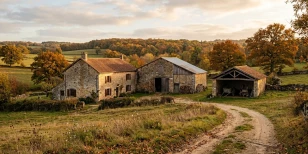

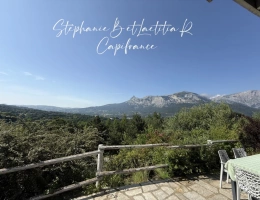
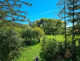
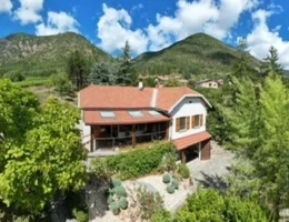
Looking for recreational land for sale in Hautes-Alpes (05) means looking at a high-mountain department, where alpine pastures, larch woods and streamside plots make up most of the agricultural or natural land on offer: hay meadows in the Champsaur, larch and pine woods in the Briançonnais, dry sunny slopes and wooded shaded slopes in the Queyras and the Embrunais. On this page, ma-propriete.fr gathers the listings of recreational land for sale in Hautes-Alpes: a mountain meadow, a wooded hillside, a plot along a mountain stream, land to develop on a valley floor.
You will find price benchmarks drawn from actual sales, an overview of the areas where these plots are concentrated, and the points to check before buying a parcel classified as agricultural or natural in the mountains. Start with our guide on how to turn agricultural land into recreational land: it sets out what planning rules permit on an agricultural or natural parcel, and what they prohibit.
There is no such thing as a "recreational land price" in the French notarial records: the DVF database records sales of agricultural land, woodland and ponds, and a recreational plot is priced against these three benchmarks, higher or lower depending on what it adds (vehicle access, a water point, fencing, an existing shelter, a village nearby). The table below gives, for each benchmark, the sales recorded in 2025 in Hautes-Alpes (05), the median price and the range between the first decile (floor) and the ninth decile (ceiling), with the national figure for comparison.
| DVF 2025 benchmark | Sales | Median price | Range (P10 – P90) | France median |
|---|---|---|---|---|
| Bare agricultural land (€/ha) * | 59 | €13,518/ha | €5,947/ha – €23,101/ha | €5,307/ha |
| Woodland (€/ha) * | 362 | €5,018/ha | €1,369/ha – €20,487/ha | €4,934/ha |
| Pond (€/m²) * | 313 | €2.54/m² | €1.03/m² – €6.90/m² | €2.54/m² |
Bare agricultural land is well above the national median (€5,307/ha), with the median price moving -9.8% between 2020 and 2025. Woodland trades close to the national benchmark (€4,934/ha), and a pond, a much rarer asset, is valued per square metre of water and banks. To compare a listing, bring everything back to the square metre: €13,518/ha of bare land is €1.35/m², against €2.54/m² for a pond. Recreational land, almost always classified as an agricultural or natural zone, generally sells slightly above bare agricultural land; but it usually remains subject to the SAFER land agency's right of pre-emption, and the SAFER may pre-empt with a downward price revision if the price is excessive compared with local land prices. These benchmarks therefore also help you avoid paying a price the SAFER would challenge.
Find the detail by department, plot size and year in our agricultural land price observatory and in the forest price observatory. Source: DVF (Demandes de valeurs foncières), 2025 sales, processed by ma-propriete.fr; medians published from 30 sales upwards. * Fewer than 30 sales in the department: the benchmark shown is the regional figure for "Bare agricultural land"; regional figure for "Woodland"; national figure for "Pond".
In Hautes-Alpes, the mountain meadow dominates: a sloping plot, often held in family co-ownership, mown once a year, with a narrow farm track for access. These are found in the Champsaur, the Valgaudemar and the Dévoluy, generally classed as non-constructible land. The woods are mostly larch and Scots-pine stands clinging to the sunny slopes, around Briançon and the Queyras, sought after for firewood more than for building.
Plots along a riverbank or mountain stream, along the Durance, the Guil or the Drac, are valued for fishing but often constrained by flood zones and the risk of flash floods. Ponds are almost non-existent here: the terrain and the torrential regime of the rivers do not lend themselves to it, unlike stretches of water on the plains. Only the Serre-Ponçon lake, an artificial reservoir, offers a large-scale stretch of water, on a completely different scale from a private pond.
The Champsaur and the Valgaudemar, around Saint-Bonnet-en-Champsaur, offer hay meadows on the valley floor, reached from Gap. The Queyras and the Briançonnais, higher up, offer larch woods and dry sunny slopes, though winter access can be limited by snow. The Embrunais, around Embrun and the Serre-Ponçon lake, combines wooded hillsides with plots close to the reservoir. The department has no TGV station: Gap is served by Intercités and TER trains, and you need to reach Valence or Grenoble to catch a TGV. In the most remote valleys, such as the upper Guil or the Dévoluy, recreational plots become scarce: it is then worth looking at accessible hay meadows or wooded hillsides in neighbouring valleys, which are more affordable.
The most affordable areas remain the valleys furthest from Gap, such as the Dévoluy and the upper Champsaur. Plots close to Embrun, the Serre-Ponçon lake and the Briançonnais resorts, more sought after, sell well above the average for the rest of the department.
The first step is to check the local planning document (PLU) or the carte communale: in an agricultural (A) or natural (N) zone, any new building is in principle prohibited, and a chalet, a cabin or a caravan cannot be installed freely outside designated areas. Check real access to the plot according to the season (rural track, right of way, landlocked parcel), the frequent absence of water and electricity on isolated meadows, and natural-hazard zones (avalanches, flash floods, landslides), systematically noted in local planning documents. In winter, snow cover can also make some plots temporarily inaccessible.
On agricultural parcels, the SAFER land agency may exercise its right of pre-emption, with a risk of the price being revised downward if it strays from local land prices, which are modest in this department. Also ask for the exact cadastral area and whether the boundaries have been surveyed: on mountain plots often inherited and divided over time, the actual boundaries can differ from the cadastre, so a fresh boundary survey by a licensed surveyor is often worth the cost before signing anything.
The listings of recreational land in Hautes-Alpes published on ma-propriete.fr come from private sellers, estate agents and notaries. Filter by area, price and the presence of a water source, then set up an e-mail alert to be notified of new plots. You can also widen your search to recreational land for sale in Provence-Alpes-Côte d’Azur.